I saw
The Hobbit II: The Legend of Smaug's Gold this weekend (in faux-IMAX, high frame frate, and 3-D for the full Jackson). There are no doubt a number of
negative reviews out there and a number of
positive ones, so you can mix and match or pick what goes with your preconceptions. Rather than trying to persuade you one way or another from an overall perspective, I'll just say: 1) it is not (as you're already aware if you saw the first one) Tolkein's
Hobbit, particularly; and 2) it's got swashbuckling action set-pieces in the Pirates of the Caribbean or Lone Ranger (2013) vein.
That out of the way, I'm going to talk about things I like about the movie that might be worth stealing for gaming.
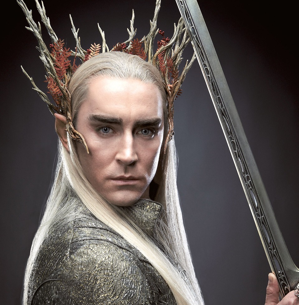
Overall, Mirkwood and the fortress of the wood elves made me wish that Guillermo del Toro had directed, as I think he would have given them both a fairy tale-ish feel that would have been visual interesting and perhaps more in keeping with the book. However, Lee Pace's haughty and fay King Thranduil is pretty much spot on. There's a part where he let's his
glamour slip and allows Thorin to see the scars he bears from fighting a dragon that does evoke elves of fairy tales or legendry that was a really good bit.
My another nice bit was Laketown. It evokes a very different feel from the Laketown of the book, but it's given a look sort of like a ramshackle Medieval Russian version of Venice. It's people are multi-ethnic and have clothing styles mixing the vaugely slavic, Tibetian, and even a bit of Mongol thrown in, but blended pretty well. It's Master is a rather Terry Gilliam-esque bumbling noble, equipped with a suitable obsequious assistant. The coldness, squalor, and police state ubiquitous informer culture the Master oversees, seems to be meant to evoke Soviet era Russia. The whole evoke is utterly un-Tolkeinian, but very interesting as a potential gaming locale.
After all of that, the movie finally arrives at Lonely Mountain and a solitary dragon. Smaug is menacingly portrayed (vocally) by Benedict Cumberbatch. The cgi design is nice, too; there's a little bit of
Dragonslayer there, I think. Smaug's treasure horde is ridiculously large. There most be no more gold in all of Middle-Earth. As Dunsany would say: "Their hoard is beyond reason; avarice has no use for it." The encounter with Smaug in this treasure den does remind one how frightening dragons ought to be, something that has been lost a bit with their perfunctory appearance in fantasy games.
Desolation of Smaug isn't a book brought to life or even a great achievement in cinema, but there are things is in it to like and nice details to appreciate.